Land Cover
For the implementation of the INSPIRE specifications for Land Cover (Annex II) the CODIIGE Technical Working Group on Land Occupation has prepared a Guide for the transformation of spatial data sets of land cover to comply with the INSPIRE Directive adjusted to Spanish needs.
This guide defines a set of common classes for all Spanish Land Cover datasets, including SIOSE, which is called "CODIIGE" classification.
SIOSE data in land cover according to INSPIRE
This implementation involves classifying each SIOSE polygon according to its majority or most representative land cover and assigning a "CODIIGE" classification value to the whole polygon.
The definition of the "CODIIGE" classes is listed below:
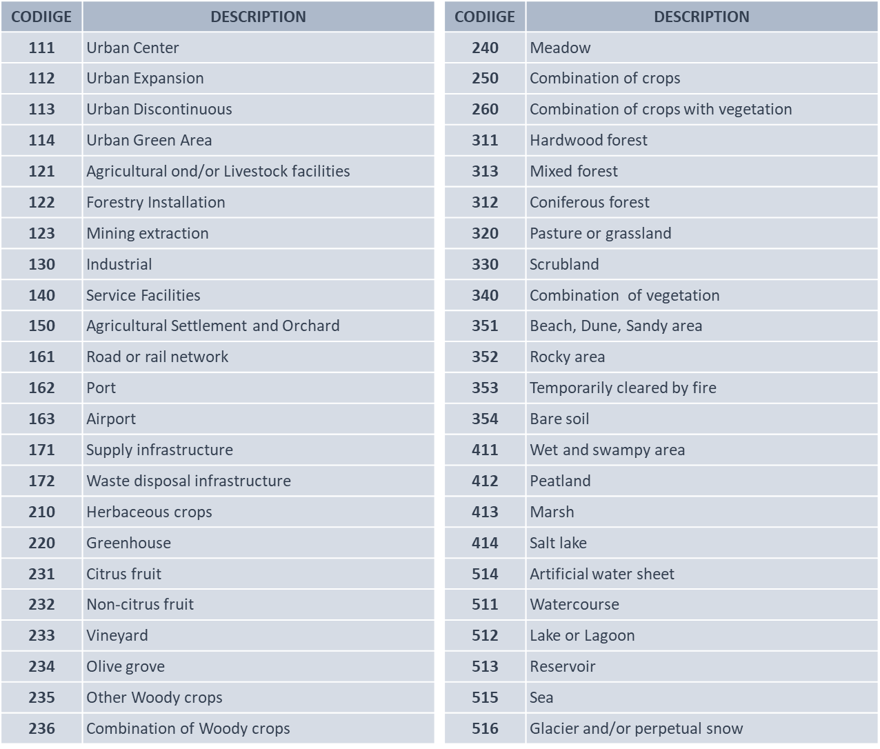
CODIIGE classes
Each CODIIGE class has an associated colour forming the legend "CODIIGE".
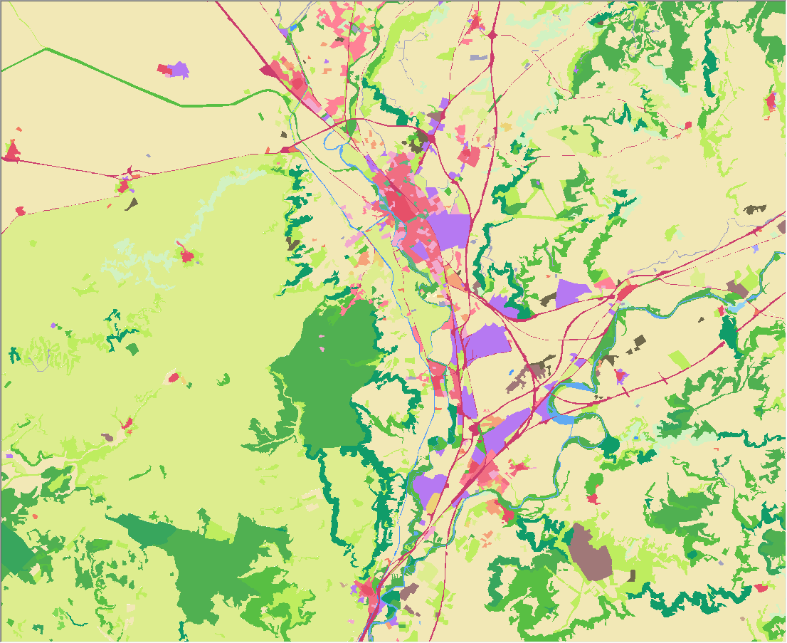
Example of CODIIGE IN CASTILLA Y LEÓN
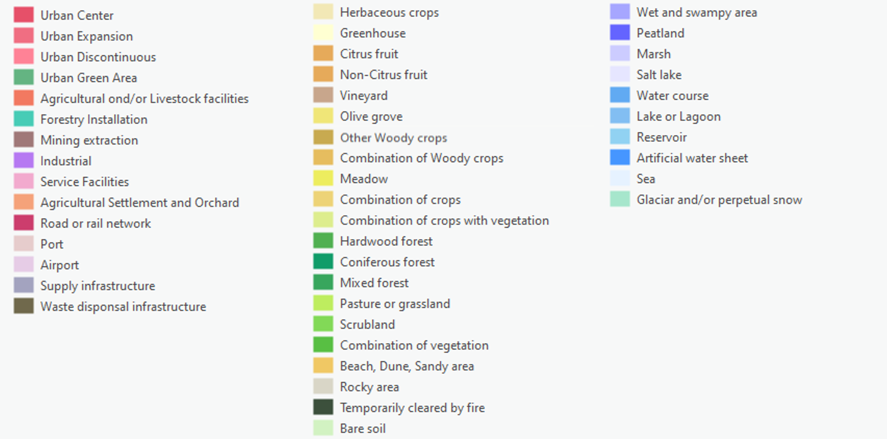
Legend CODIIGE
This "CODIIGE" classification is listed in table TC_SIOSE_CODIIGE of the SIOSE database.
This table is related to the SIOSE polygon table (T_POLYGONS) through the common field 'HILUCS':
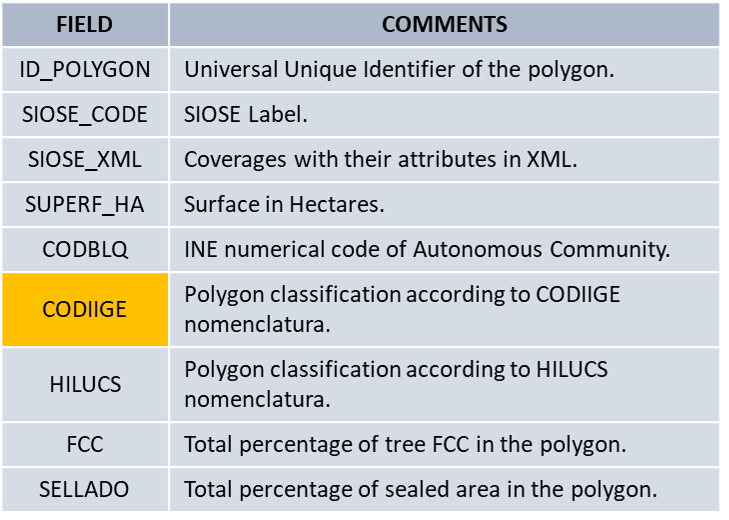
TABLE T_POLYGONS
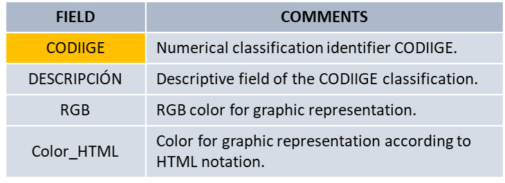
TABLE TC_SIOSE_CODIIGE
For more information, please see the Regulations and other documents section in the legislation of the IDEE Geoportal sub-section.
To download, please see the section on Products.


