CLC+ and EAGLE CLC+
CLC+
The European Environment Agency, as coordinator of the Copernicus Land Monitoring Service (CLMS), has started to develop and implement a new set of products, under the name CLC+. These new products represent a second generation of the traditional CORINE Land Cover, and complement and extend the existing suite of CLMS products to better align with the growing need for information on land cover and land use by Europe's spatial policies and initiatives.
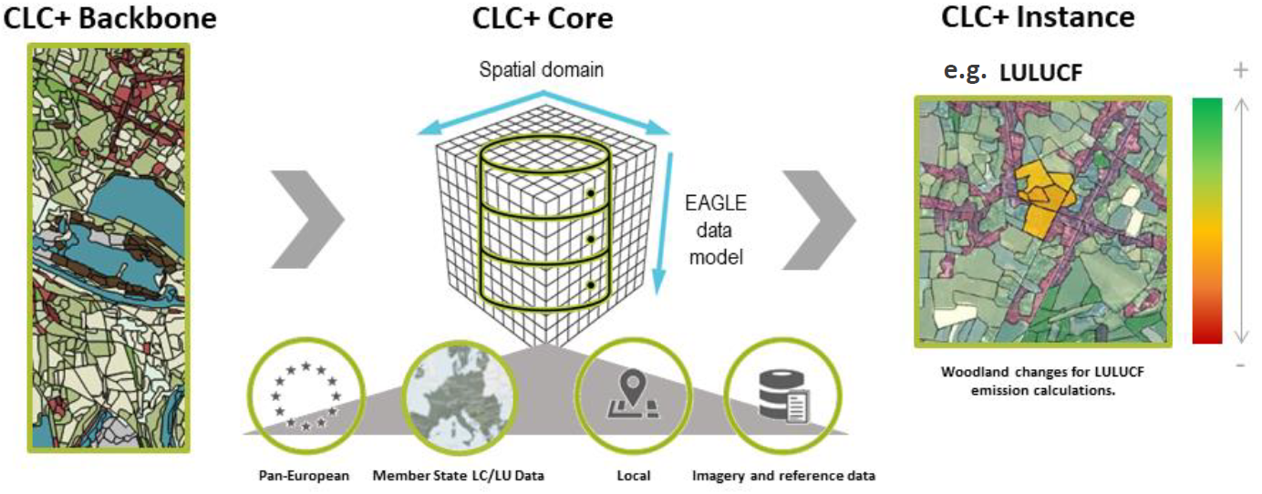
CLC+ concept and components:
- CLC+ Backbone: Product with a high level of detail that classifies the whole European territory into basic land cover classes. Minimum polygon size 0.5 Ha and pixel size 10 m. CLC+ Backbone is compliant with the EAGLE data model.
- CLC+ Core: Product containing key thematic information on land cover and land use with a 100 m grid-based structure. CLC+ Core is compliant with the EAGLE data model and contains thematic information from other CLMS products (e.g. CLC+ Backbone, HRLs, etc.), member states and other data sources.
- CLC+ Instances: Thematic CLC+ Backbone and CLC+ Core products addressing specific territorial needs in terms of land cover and land use. For example, the LULUCF Regulation, Common Agricultural Policy, continuity of the traditional CORINE Land Cover, etc.

Set of CLC+ products AEMA
EAGLE CLC+
The EAGLE action group (Eionet Action Group on Land monitoring in Europe) was set up in 2009 and contributes to the evolution of the Copernicus Land Monitoring S ervice. It is a action group of European experts belonging to the "European Topic Centre on Spatial Information and Analysis" of the Eionet Network (European Environment Information and Observation Network). Its aim is to advance in the analysis and evaluation of different technical and organisational aspects that condition the management and use of information on Land Occupation at European level and within the Copernicus programme.
EAGLE proposes an innovative scenario in the production of CORINE Land Cover through the harmonisation of national data and a subsequent integration at European level.
The work carried out by EAGLE includes the following:
- A tool for semantic comparison between different land cover systems by decomposing classes into elements of land occupation, land use and landscape features.
- A conceptual data model, in UML notation. Following ISO19109 (Geographic Information - Rules for the application schema), remaining ISO standards and as an extension of the INSPIRE specifications on land occupation in Europe.
- Database structure according to the model, which allows data to be stored and maintained for easy consultation by a wide range of users for a variety of purposes.
- Set of aggregation rules in general for building a common European scenario for generating continental databases from more detailed national datasets.


